Senile Texas Aggie - comic relief for the rest of you

greybeard

Herd Master
Joined
Oct 23, 2011
Messages
5,940
Reaction score
10,803
Points
553
Location
East Texas
Permanent survey markers are generally only installed at property line corners, tho the surveyors may leave some temporary markers as waypoints in the middle of a long run. Here, the surveyors install wooden laths with orange ribbon as a way point, and another at each corner, but also drive a metal rod with orange or white top down to ground level or just below ground level at property line corners. They look like a giant nail, several feet long with a flat top....may or may not have writing on the 'nailhead'.
If you find one of the markers, leave it alone, but it is fine to drive your own (more visible) marker down right behind it. I usually use a length of 2" X 2' long angle iron, as it kind of encapsulates the surveyor's official rod while still allowing them to find it.... as well as me being able to find it easily without a metal detector.
Yesterday, I happened to be over in an area I knew one the official markers was still visible behind my own larger marker.
The little yellow 3/4" round doohickey is the top of the surveyors permanent marker. The steel channel iron is a post I drove right in front of their marker. There is some writing stamped into the top of it, but it didn't show up in the photo.
Picture1123181635_1.jpg


Picture1123181634_1.jpg


I built my fence in such a way that all of it, posts and wire, would be 100% on my property. This precludes any future property owner/'next door neighbor' from changing my fence in any way.
If a new 'neighbor' wants to have a different kind of fence, they can build their own. They are not using my posts.
 

Senile_Texas_Aggie

Herd Master
Joined
Jun 3, 2018
Messages
1,870
Reaction score
5,465
Points
343
Location
western Arkansas
All,

My Beautiful Gal and I decided to visit some parts of our property that we had never visited before. We visited the southernmost point and found an orange T post that perhaps was the boundary (point A below). Then we drove to the westernmost portion of the south mowed pasture and walked southwest, up the ridge a ways, till we saw the remains of a fence that had been fastened to a tree, with the tree having grown around the barbed wire (point B below). But we did not see any sign of orange stakes around anywhere.
20181125_150400_property_visits.JPG

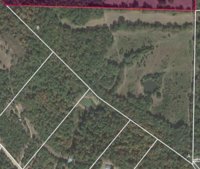
Do you folks know of any good app for Android (Samsung Galaxy) that will work to show property boundaries even when offline? For most of our property we do not have a good cellphone signal, although I can prepare the app with any maps before proceeding away from the house. I have installed HuntStand, as that was recommended by a viewer of an episode of the Stony Ridge Farmer, and it MAY do the job, but I would like to get you folks' inputs.

Senile Texas Aggie
 

greybeard

Herd Master
Joined
Oct 23, 2011
Messages
5,940
Reaction score
10,803
Points
553
Location
East Texas
I have frequently used Google Maps, but I thought Google Maps had to have access to the internet/cellphone network whenever it was being used. Is there a way to use it without access to internet/cellphone network?
Google maps won't work without an internet signal of some sort..cell, sat, broadband etc. Of course, you can always print out the image of YOUR property when at a location that does have service...which will help significantly.
You can also, find the GPS coordinates of your property lines off a previous survey, and use any of several hand held gps devices or a good cell phone with gps capability. You really need one that uses both US GPS and GLONASS satellites. GLONASS will reportedly get you a lot closer than just usin standard GPS.. A metal detector and Etool will be a big help too.

There are other online apps and programs that find corners for real estate agents but they require certain info and problem is, not every area has GIS data.
https://www.gislounge.com/five-gis-and-map-apps-iphone/

reading..
https://propertylinemaps.com/p/pdf-cell-phone-find-property-lines.pdf


Another option, which I successfully used about a dozen years ago, was to get the info off the most recent survey and find your corners with a good compass......you will need to first shoot or establish an azimuth, a pedometer as well or a 300' tapeline..and a helper.
(running a compass course in the daylight and dark was one of the things that stuck with me from my Marine Corps time.)


There are some apps you can buy but I don't know how good they are of if they are any better than going to your county a getting a copy of the last survey maps.

I have no idea how accurate or how well these work:
https://findpropertylines.com/p2/find-property-lines.html
https://www.techwalla.com/articles/how-to-determine-a-real-property-boundary-with-gps

Hunting/hunter discussion boards are a treasure trove for this kind of information.
 
Top